Using Drones to Make Roads Safer
Dernière mise à jour le 21 novembre 2017
« Toutes nos excuses, nous préparons le parachute et traduisons notre nouveau site web. Atterrissage imminent des pages françaises ! »

Unmanned Aerial Vehicles (UAVs) or “drones” are being used by traffic engineers and road safety professionals to enhance data collection and road safety efforts. On September 8, 2017, we sat down with Mark Hearson, a Rhodes Scholar in civil engineering and Transport Infrastructure Specialist from Fireseeds North Infrastructure in Winnipeg, to discuss how drones are changing traditional approaches to road safety.
How is the work of Fireseeds North Infrastructure related to Vision Zero? What do you see as the benefit in working with the Parachute Vision Zero Network?
We work with jurisdictions across Canada and internationally, to reduce fatalities and injuries on their roads, through improved transportation planning, design, operation and maintenance. While we collaborate with partners across many road safety disciplines, our core specialization at Fireseeds North Infrastructure is road safety engineering. This specialization is fuelled by the desire to reduce fatal and serious injury collisions, through improved infrastructure leadership. Our portfolio of road safety services is broad. It includes road safety management systems, road safety strategies, road safety audits, in-service road safety reviews, collision analyses, risk mapping, network screening, safety performance functions, surrogate safety analysis, video analytics, as well as road safety policy and guidelines. The breadth of these services hints at the number of different, yet complementary approaches to reducing serious collisions.
To meet Vision Zero objectives, work in road safety engineering must occur in conjunction with road safety enforcement, education and emergency response. It is important that this work does not occur in silos, and I think that the Parachute Vision Zero Network plays a key role in connecting people and promoting awareness across road safety disciplines. Vision Zero has gained significant traction in Canada in recent years, partly thanks to advocacy and information-sharing by key players. While our firm could not attend the 2nd Annual Parachute Vision Zero Summit this fall, I am confident the connections established at the Parachute Vision Zero Summit will continue to strengthen our national network of professionals working toward the vision of eliminating road fatalities and injuries in our country.
Your company is doing a lot of work with drone technology. How can this enhance road safety? What can we do with drones which we couldn’t before?
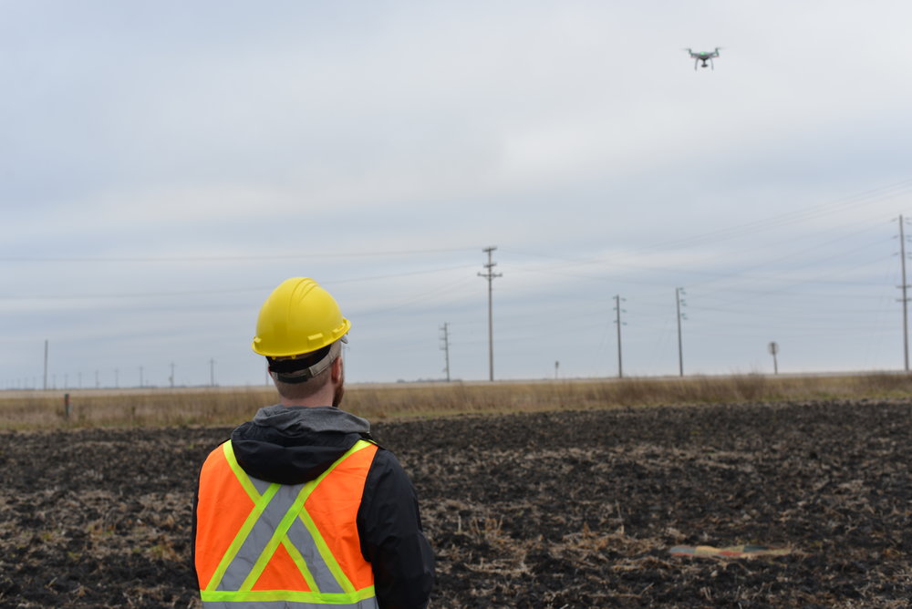
Simply put, UAVs represent another method of collecting operational data for road safety analysis. Recent advancements in UAV flight stability, automation and high-resolution cameras and sensors have all contributed to a market rich with flexible and easy-to-use systems. High-end recreational UAVs offer impressive flight stability and acceptable flight times at a very accessible price. These systems are suitable for applications such as driver behaviour studies and short-term traffic counts. There are several off-the-shelf industrial solutions and customizable platforms which are better suited for applications requiring longer flight times, increased flight path automation, and so on.
These systems do not necessary unlock new road safety practices, however they offer greater flexibility and cost-effectiveness than other data collection methods. In many cases, the vantage point of UAVs enables continuous data collection of a site, using one camera or sensor – as opposed to the multiple cameras, sensors, or visual observers which would be required without a UAV. Furthermore, the proliferation of UAV manufacturers, educators and third-party operators makes it much easier to launch a UAV-based project or program than ever before.
What are some of the most common applications for drones, when it comes to road safety?
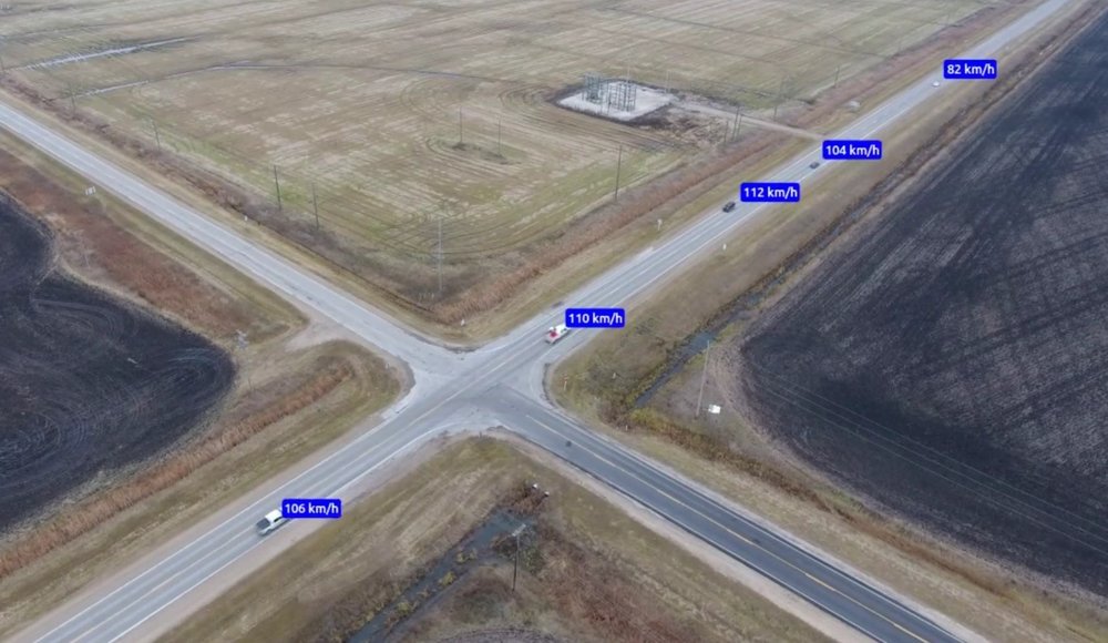
There is a long list of applications, including accident reconstruction, before-and-after studies, behaviour studies (cyclists, drivers, and pedestrians), emergency response, enforcement, event management, in-service road safety reviews, speed studies (see image below), surrogate safety analysis using video analytics, traffic management, traffic monitoring and work zone safety. UAV applications for asset management – such as pavement condition data collection, thermal imaging, LiDAR scanning, and aerial mapping – are also relevant to road safety, as the condition of our road infrastructure can affect safety performance.

UAV applications in road safety are likely to evolve over time with increased use. UAV adoption for road safety application in Canada is still in its infancy, and Canadian jurisdictions have been slower to adopt these practices when compared to counterparts in other countries. To date, the most common applications of UAVs to road safety are driver and pedestrian behaviour monitoring and in-service reviews of new or upgraded facilities. Many of these projects were partly motivated by public engagement purposes; UAV video footage is undeniably an impressive way to showcase new road facilities.
There are many opportunities for jurisdictions to launch pilot programs to push the industry forward. Fireseeds North Infrastructure will continue to explore these opportunities with jurisdictional partners who are interested and motivated to integrate UAVs into their road safety management as part of pilot projects or more comprehensive implementation plans.
Which of these applications has the most potential to prevent collisions?
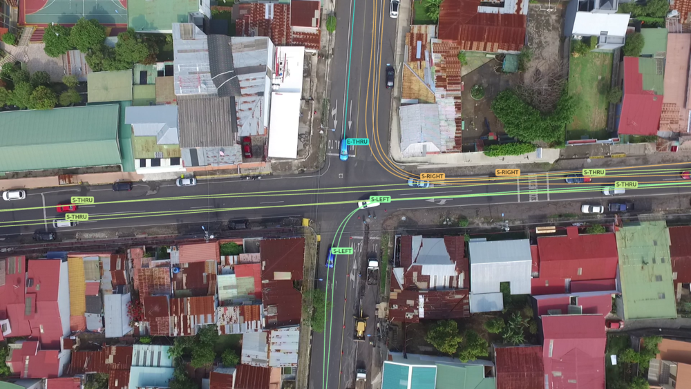
Video analytics leverage computer vision and machine learning to extract road user trajectories (see image below) and detect conflicts or “near misses”. This type of analysis is critical for Vision Zero jurisdictions. Conflicts are proactive road safety indicators and occur much more frequently than collisions, meaning we can collect a large dataset in little time. Conflict analysis allows us to achieve an in-depth understanding of the road safety problem, from which we can make informed decisions before people are injured or killed on our roads. Given their flexibility, accessibility and vantage point for data collection, UAVs encourage more frequent incorporation of video analytics into road safety studies (e.g. before-and-after studies and in-service road safety reviews). Video analytics also serve as additional data sources to support performance-driven programs.

What, if any, are the barriers to using this technology? Or other technology that you may use?
Inclement weather presents obvious challenges which may restrict someone from collecting suitable data (particularly if UAV flight stability is important) and may altogether prevent a flight on a given day. This may be a greater barrier for real-time applications, or other applications where data collection needs to correspond to a specific event. However, most applications we endorse are not date-specific and data collection can be shifted for better flying conditions.
Battery life is a constraint for some applications. High-end recreational or light industrial UAVs often have a flying time between 20 and 30 minutes. Customizable platforms can have multiple batteries, or have an alternative power source, which enables a longer flying time. If flying time is a major factor, tethers providing constant power can enable persistent data collection and monitoring, as well as reduce fly-away risk.
While some would consider UAV regulation to be a moving target and barrier to UAV use, it serves a critical role in protecting the public, aircraft and property. Regulation of UAV use in Canada, including both industrial and recreational uses, is the responsibility of Transport Canada. In terms of road safety applications, the minimum lateral offset to the study site is a key factor in study feasibility. Proximity to airports and aerodromes may also prevent UAV use in certain locations.
As an engineer and road safety professional, what excites you the most about drone technology?
On both personal and corporate levels, using UAVs to collect video data for surrogate safety analysis is of great interest to me, particularly for rapid before-and-after studies. Many jurisdictions are restricted in their ability to pilot and implement new road safety treatments and improvements, due to the obvious lack of safety or operational data. With video analytics and surrogate safety analysis, a jurisdiction can rapidly evaluate a new treatment – and if successful, implement the improvement across their network. The perspective of capturing large and complex transportation facilities from a high vantage point is also an exciting feature afforded by UAVs. Being able to capture road user behaviour across a complex interchange using a UAV could provide valuable insight, which previously could only be visualized through microsimulation.
What is the future of drone technology in this field? What other technologies will emerge?
In the short-term, UAVs are a flexible platform which several different industries can build on. It is only a matter of time for developers around the world to find synergies between UAVs and other technologies for commercial or societal benefits. Most recently I read of a Swiss company, FlyPulse, which is equipping UAVs with defibrillators (AEDs) to reduce response time for people experiencing cardiac arrest outside of a hospital. Companies like DroneSeed and BioCarbon Engineering are developing UAVs with spraying and aerial planting capabilities for reforestation. While these are not road safety applications, my best guess is that this creativity will push the industry forward and fuel new applications in other areas. I also see UAV technology piggy-backing on the immense research and development of automated and autonomous systems.